
| |
|
|
Related mediaQuestions for thought
The meanings of words
Related stories
Latitude and Longitude
Basic information including definition of numbering system. Nationalatlas.gov Map Projections Nationalatlas.gov History of the Royal Observatory, Greenwich Home of the Prime Meridian the clock that let us know longitude. Royal Museums Greenwich John Harrison and the Longitude Problem About John Harrison and his major technological achievement - making a chronometer (clock) that kept time well enough to accurately determine longitude at sea. Royal Museums Greenwich Where is zero degrees longitude on Mars? Home of the Prime Meridian the clock that let us know longitude. European Space Agency (ESA) Astrogeology Science Center Includes links to geologic and topographic maps of planetary bodies. U.S. Geological Survey (USGS) |
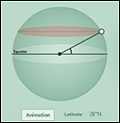 Latitude
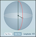 Longitude
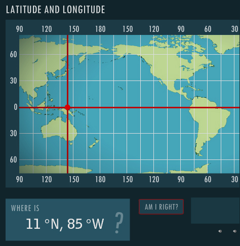 Latitude and Longitude