Virtual view of the San Andreas Fault
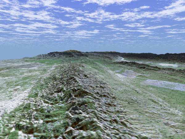
Trace of the San Andreas Fault west of Bakersfied in the Carrizo Plain - View is oriented towards the southeast looking from the Central Valley, CA.
"The fault is the distinctively linear feature to the right of the mountains. To the left of the range is a portion of the agriculturally rich San Joaquin Valley. In the background is the snow-capped peak of Mt. Pinos at an elevation of 2,692 meters (8,831 feet). The complex topography in the area is some of the most spectacular along the course of the fault. To the right of the fault is the famous Carrizo Plain." - NASA.
This map was created by combining elevation data collected by radar instrumentation aboard the Shuttle Endeavour on February 16, 2000 with Landsat imagery collected on December 14, 1984.
Image courtesy NASA. For more images, see NASA Visible Earth.
Other images of the San Andreas Fault
Palmdale, CA
Intersection with Garlock Fault
San Francisco, CA
North of Los Angeles
Back
Updated: Oct. 22, 2002
©1999-2002 by the Regents of the University of California.
All rights reserved.
![]()