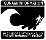
Warning Systems  Tsunami warning sign.
Redwood National Park in northern California. Image courtesy National Park Service. "The West Coast/Alaska Tsunami Warning Center objectives are to rapidly locate and size major earthquakes in the Pacific basin, determine their tsunami potential, predict tsunami arrival times and, when possible, runup on the coast, and provide timely and effective tsunami information and warning bulletins for the Pacific coastal populations of California, Oregon, Washington, British Columbia, and Alaska." National Weather Service, NOAA Pacific Tsunami Warning Center "Established in 1949, the Pacific Tsunami Warning Center (PTWC) in Ewa Beach, Hawaii, provides warnings for teletsunamis to most countries in the Pacific Basin as well as to Hawaii and all other US interests in the Pacific outside of Alaska and the US West Coast. Those areas are served by the West Coast / Alaska Tsunami Warning Center (WC/ATWC) in Palmer, Alaska. PTWC is also the warning center for Hawaii's local and regional tsunamis." National Weather Service, NOAA International Coordination Group for the Tsunami Warning System in the Pacific United Nations Educational, Scientific, and Cultural Organization, Intergovernmental Oceanographic Commission (UNESCO/IOC) Indian Ocean nations to get tsunami warnings CNN.com, Science& Space International Tsunami Information Center United Nations Educational, Scientific, and Cultural Organization, Intergovernmental Oceanographic Commission (UNESCO/IOC) Instrumentation Deep-ocean Assessment and Reporting of Tsunamis "As part of the U.S.National Tsunami Hazard Mitigation Program (NTHMP), the DART Project is an ongoing effort to develop and implement a capability for the early detection and real-time reporting of tsunamis in the open ocean." Learn more about this program and how tsunami are detected. Pacific Marine Environmental Laboratory, NOAA Predicting areas at-risk Center for Tsunami Inundation Mapping Efforts "The Center for Tsunami Inundation Mapping Efforts (TIME) was created to assist the Pacific States in the development and maintenance of maps which identify areas of potential tsunami flooding." National Tsunami Hazard Mitigation Program, NOAA |
||||||||
|